KEEP VICTORIA FALLS WILD

KEEP VICTORIA FALLS WILD
Save Victoria Falls from over-development - click to visit site - www.keepvictoriafallswild.com
Showing posts with label environmental degradation. Show all posts

Wednesday, 31 December 2014

Paradise lost?

We've recently posted an archive article from January 1995, 'Victoria Falls - A Fragile Power', written by Sally Wynn and originally published in Africa Geographic magazine. It is critical of developments around Victoria Falls, developments which have continued in the years since it was first written, notably with large areas being fenced off for the operations of captive animal interactions

Other recent developments include the Wild Horizon's Gorge Swing site below the Victoria Falls Hotel, which now dominates the second gorge following recent expansion to accommodate a restaurant overlooking the gorge - including the clearing of a large section of bush for a coach and car park.

When Sally Wynn wrote her article on the Falls, the Victoria Falls Safari Lodge had just recently opened (in November 1994) - note her comment: "Victoria Falls Safari Lodge, for example, is built on land originally set aside as a wildlife corridor from the Zambezi National Park to the river. This has created a whole new problem - keeping potentially dangerous large animals at a safe distance from tourists."

Over the two years I've been running this blog I've recorded many human-animal conflict events in Victoria Falls, including most recently a whole heard of buffalo chased into the town by lions. Some of these events have resulted in human deaths, including one which tragically occurred at VFSL itself. 

African Albida, who operate VFSL, have just launched another large development, Santonga, on virgin land adjoining the lodge, and with stories circulating of planned hotel developments on neighboring land along the river at this point, an essential wildlife corridor that has allowed animal movement to and from the river will be almost completely blocked. In fact it will complete an arc of development encircling the falls on the Zimbabwean side, and preventing larger animals accessing the Big Tree/Zambezi Drive area just above the Falls, which to this day frequented by elephant and buffalo and part of the magic of Victoria Falls. It may even result in the reduction of wildlife visiting the famous VFSL waterhole, as it is located on this wildlife-corridor, and will probably result in more potentially fatal human-wildlife conflict events whilst animals try to find new routes to and from the river.

The Santonga development was recently described by Tourism and Hospitality Industry Minister Walter Mzembi as a biodiversity' project and by reporters as a 'conservation park'. It appears to have little biodiversity or conservation value by any traditional definitions of either word. However it does sound more like a theme park with captive animal interactions. When will tourism operators in Zimbabwe (and Zambia, who are planning similar captive parks on their side of the river) realize that tourists want to see Africa's wild animals in the wild, not enslaved into novelty tourism activities - they can see captive animals in zoos and safari parks in their own countries. And even these are going out of fashion and struggling to survive.

Ironically Africa Albida and VFSL have repeatedly been the winner of 'green' eco-awards over its first 20 years (given, of course, by the tourism industry rather than by conservationists!). Much of this has been in valid recognition of its support for local anti-poaching initiatives. It is a reputation, however, about to be destroyed, together with the degradation of a significant element of the  ecological value of the immediate Falls.environment.


Victoria Falls is a unique and fragile ecological environment, one that is being suffocated, bit by bit, by the ever growing demands for development
, part of what Mzembi hails as the creation a 'Niagara' - a US$30 billion economy around Victoria Falls - and including a 'Disneyland in Africa' development next to the Victoria Falls Airport.

Together with the development of the Batoka Gorge Dam, a project which threatens to flood the rapids below the Falls, these  natural wonder of the Victoria Falls is slowly being despoiled, despite all the designations designed to protect it. 

See Also

Victoria Falls Bits and Blogs (31st December 2009) Albida Tourism in $12m expansion drive.

Victoria Falls Bits and Blogs (16th December 2014) Santoga Project an Insult to Vic Falls?.

Victoria Falls Bits and Blogs (31st December 2014) Paradise lost?.

Victoria Falls Bits and Blogs (21st April 2015) Work on $18M Victoria Falls Santonga captive animal park starts.

Victoria Falls Bits and Blogs (24th April 2015) Vic Falls recreational park to open in 2017.

Victoria Falls Bits and Blogs (27th April 2015) $18m park set for Vic Falls.

Victoria Falls Bits and Blogs (15th May 2015) Santonga Project rattles Vic Falls.

Victoria Falls Bits and Blogs (22nd May 2015) Santonga Project: The untold story.

Victoria Falls Bits and Blogs (8th June 2015) ‘Santonga is not a zoo’.

Victoria Falls Bits and Blogs (24th July 2015) Santonga: Tourism game changer?.

Victoria Falls Bits and Blogs (9th September 2019) Santonga Project still on the cards.

Read more on the Keep Victoria Falls Wild website

Monday, 24 November 2014

Zambian mine threatens world heritage site

The high court in Zambia is hearing an application from civil society organisations that are trying to stop the granting of a licence for a copper mine in the Lower Zambezi National Park.
Australian-owned mine Zambezi Resources Limited was given a 25-year permit in 2011 to prospect and mine in the Lower Zambezi National Park. The Kangaluwi Copper Project will see an opencast mine being built in the park, which is a formally protected area and part of the Zambezi River’s catchment zone.
It is also across the river from Mana Pools in Zimbabwe, a world heritage site.
The International Union for the Conservation of Nature lists the Lower Zambezi National Park as a category two protected area. This means it must be maintained for “ecosystem protection” and recreation. In 2011, the United Nations Educational, Scientific and Cultural Organisation encouraged the Zambian government to apply to make the park a world heritage site – this would then create a trans-boundary park with Mana Pools.
Compromising ecological value
The park stretches along 120km of the Zambezi River, and the government’s tourism agency says it is the fourth most visited park in the country. In 2012 the Zambian Environmental Management Authority rejected the mine’s environmental impact assessment.
“The proposed site is not suitable for the nature of the project because it is located in the middle of a national park, and thus intends to compromise the ecological value of the park as well as the ecosystem,” it said.
But in February the mine was given permission to go ahead by Zambia’s minister for Lands, Natural Resources and Environmental Protection. But this was temporarily halted, thanks to a court challenge from the Zambia Community Natural Resources Management Forum.
The mine has said it will make a mine that does not damage the ecosystem in the park. Earlier this year it released a statement saying, “Zambezi Resources promises to build the world’s greenest copper mine.”
Negative consequences
Groups opposing the mining say it is within the middle Zambezi elephant corridor. This was created to allow the herbivores to move freely along their traditional migratory routes. It is also home to several endangered species, such as the African wild dog.
One of the principal opposition groups, the Zambian Community Based Natural Resources Forum – a grouping of non-governmental and community organisations – said the mine would “generate negative impacts” beyond Zambia’s borders. It would lead to “significant alteration of the area’s hydrological system”.
This would threaten Mana Pools in Zimbabwe, and was therefore threatening to create conflict between the states, it said in a statement last week. It would also be in contravention of regional water sharing agreements, it said. “The mining operation is likely to increase surface and ground water contamination in the Zambezi River and other local streams.”
It said that while the mine would create 250 jobs, more than 800 people were employed in local tourism. The mine would “lead to significant loss in tourism operations”.
Given the mine’s sensitive location and potential adverse impact on tourism, the group said it should not go ahead. “There is no feasible scenario under which the proposed project would proceed without causing severe and far-reaching environmental and geopolitical impacts.”
‘Stop the mine’
A discussion document paper on best practice for mining in the whole Southern African Development Community region, drafted by mining consulting firm Estelle Levin and released two months ago, found that Zambia’s “strong legal framework” was not being implemented. 
It used the Kangaluwi Copper Project as a case study. “Flaws have resulted in expert advice being disregarded and mining developments permitted in protected areas of high biodiversity call,” it said.
A comprehensive report by independent reviewer Dr Kellie Leigh, done for opposition groups, and released last week, proposed that the mining be scrapped. “There is considerable risk of long-term damage beyond the life of the project, to the health and well being of communities, wildlife and the environment.”
It also said that if the mine went ahead, it would set a dangerous precedent for other mining in national parks.
Last week a coalition of Zimbabwean civil society groups called on their environment minister to put pressure on his Zambian counterpart to stop the mine.
Source: Zambian mine threatens world heritage site (Mail & Guardian, SA, 23/11/14)
SIGN THE ZAMBEZI SOCIETY'S ONLINE PETITION HERE
READ MORE ON THIS ISSUE HERE.

Friday, 31 May 2013

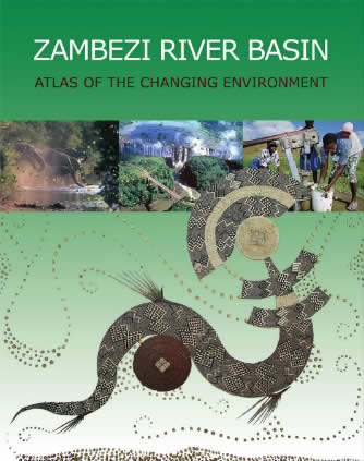
Major Project Maps Change in Zambezi Basin


A major report has been published (available online here) looking at landuse and wider environmental change across the Zambezi River catchment, and highlights the many pressures facing the environmental integrity of the region.
The Zambezi River Basin Atlas of the Changing Environment looks at climate and human pressures on natural resources across the river basin, which encompasses part of eight countries — Angola, Botswana, Malawi, Mozambique, Namibia, the United Republic of Tanzania, Zambia and Zimbabwe.
The Atlas uses satellite images, high resolution photographs, illustrative text and graphics to investigate various issues in the Zambezi basin, from use of water and other natural resources, as well as socio-economic and cultural aspects, and identifies climate change and population growth as major drivers of environmental change.
Satellite images show that the basin has undergone major environmental changes in the past 20 years. These include land degradation, loss of forests, expansion of urban and mining areas as well as the spread of alien plant species. According to the Atlas, the population of the basin in 1998 was 31.7 million compared to an estimated 40 million in 2008, with 7.5 million people living in urban centres.
Most countries in the basin are urbanizing rapidly, putting pressure on finite resources. The Atlas illustrates the deforestation of large areas surrounding Lilongwe in Malawi, among others, due to the high demand for firewood and land for farming by the growing population.
Mining is a major economic activity in the basin and satellite images reveal striking land-use changes as a result of mining activities, notably in Zambia. The revival of copper mining at Kanshanshi and Lumwana mines in Solwezi in north-western Zambia has led to a population influx, resulting in the rapid but haphazard expansion of the town. As a result, surrounding forested areas have been cleared for firewood and peri-urban farming.
Sub-basins such as the Luangwa River, Lake Kariba, and the Kafue and Kabompo rivers also have high concentrations of mining operations, contributing to water pollution in the Zambezi river. In addition, highly urbanized sub-basins such as the Kafue and Manyame are discharging waste into the Zambezi river system. The use of fertilizers and agrochemicals are contributing to the growth of harmful aquatic plants. Water hyacinth growth is a problem throughout the basin, and areas particularly affected include the Kafue Flats in Zambia, Lower Shire in Malawi, Lake Kariba between Zambia.
Zambezi River Basin Atlas of the Changing Environment, the first of its kind in southern Africa, is a collaborative initiative with the objective of providing scientific evidence about changes that are taking place in the environment. The Atlas is being produced for the Southern African Development Community (SADC) Water Division, the Interim Secretariat of the Zambezi Watercourse Commission (ZAMCOM), and Zambezi River Basin stakeholders, by the Southern African Research and Documentation Centre (SARDC) through its environment institute, the I. Musokotwane Environment Resource Centre for Southern Africa (IMERCSA) and GRID-Arendal, both collaborating centres of the United Nations Environment Programme (UNEP).
The Atlas is available online to download here.
Original source: ZAMCOM: Changing the Environment in the Zambezi River Basin


Wednesday, 8 May 2013

Barren future for Africa's soils


The Soil Atlas of Africa was presented to the Afican Union in Addis Ababa last week after five years of expert collaboration between the AU, the EU and the UN’s Food and Agricultural Organisation. The scientists hope that their new report and atlas on the soils of Africa will help to reconnect the continent’s people to their roots and raise awareness about the critical significance of soil to human existence and the authors suggest that the importance of soil is not widely understood.
“Part of the problem is that with an increasingly urban society, many people have lost contact with the processes that produce food. Most people expect to find goods on the shelves of supermarkets and have limited appreciation of the role played by soil.”
One of the most critical findings is that Africa’s soils are running out of vooma. Simply put, the soil is losing nutrients faster than fertilisers can be added. The authors say many of the soils of Africa are severely degraded by erosion and excessive nutrient depletion. On average, African farmers can afford to apply only 10 percent of the fertilising nutrients that farmers in the rest of the world return to the soil.
Adding to the problem is the fact that more than half of Africa’s land surface is made up of sandy soils (22 percent), shallow stony soils (17 percent) and young, weakly developed soils (11 percent). Deserts and drylands make up 60 percent of the land surface and fertile areas are under growing pressure because of the global trend to grow cash crops for export.
“Using state-of-the-art computer mapping techniques, the Soil Atlas of Africa shows the changing nature of soil across the continent. It explains the origin and functions of soil and describes the different soil types and their relevance to both local and global issues.”
Read full article here, and more background here. Photographic credit here